The SmartGNSS receiver has been specially built for agricultural industry. Being installed to agricultural machinery it provides information for precision farming systems, navigation and automatic control. SmartGNSS contains a receiver module and an antenna designed by leading manufacturers which guarantee its high stability and performance.
CONSTRUCTION
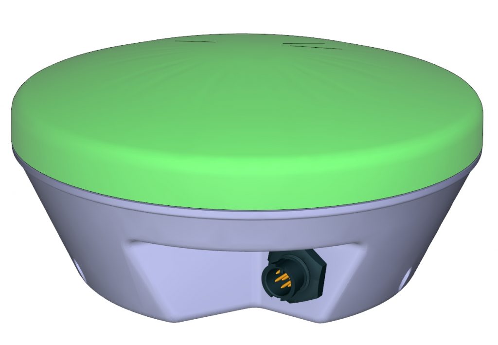
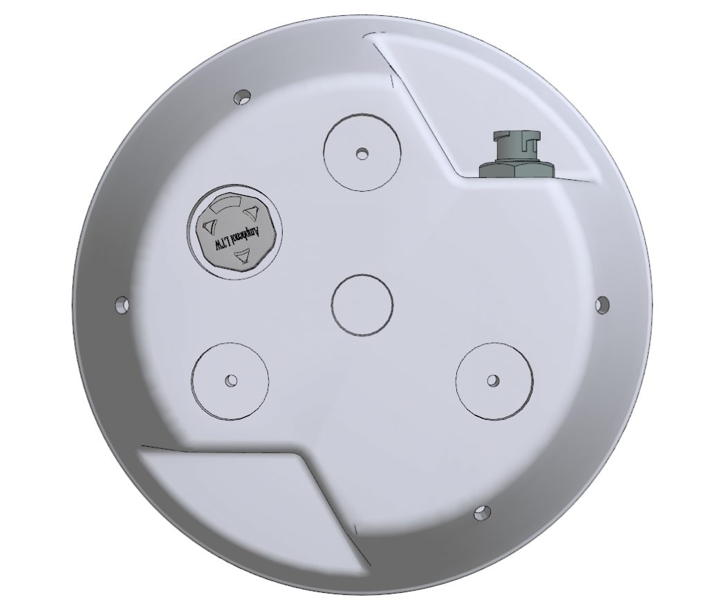
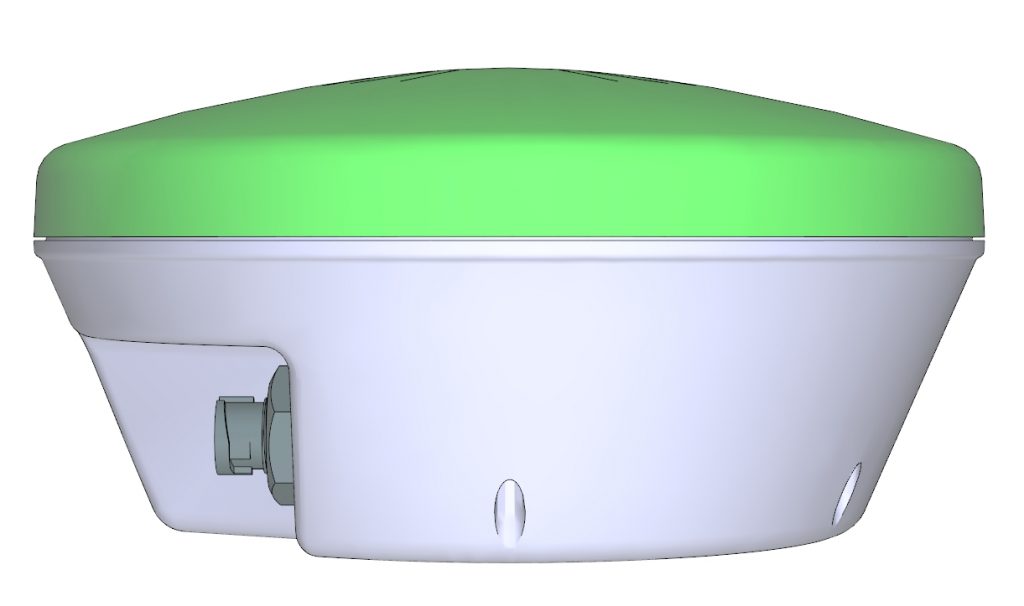
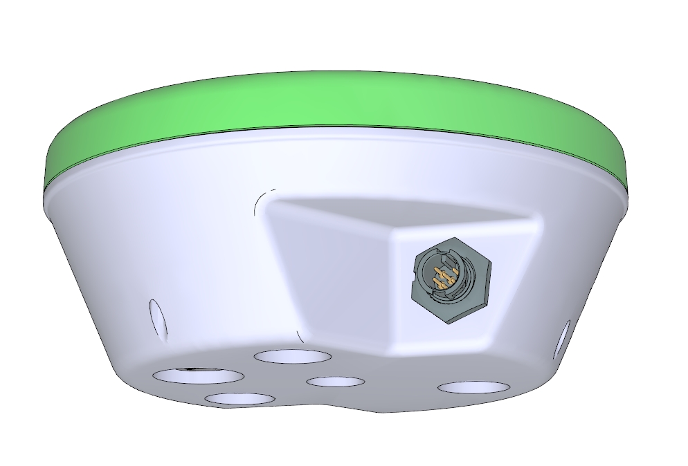
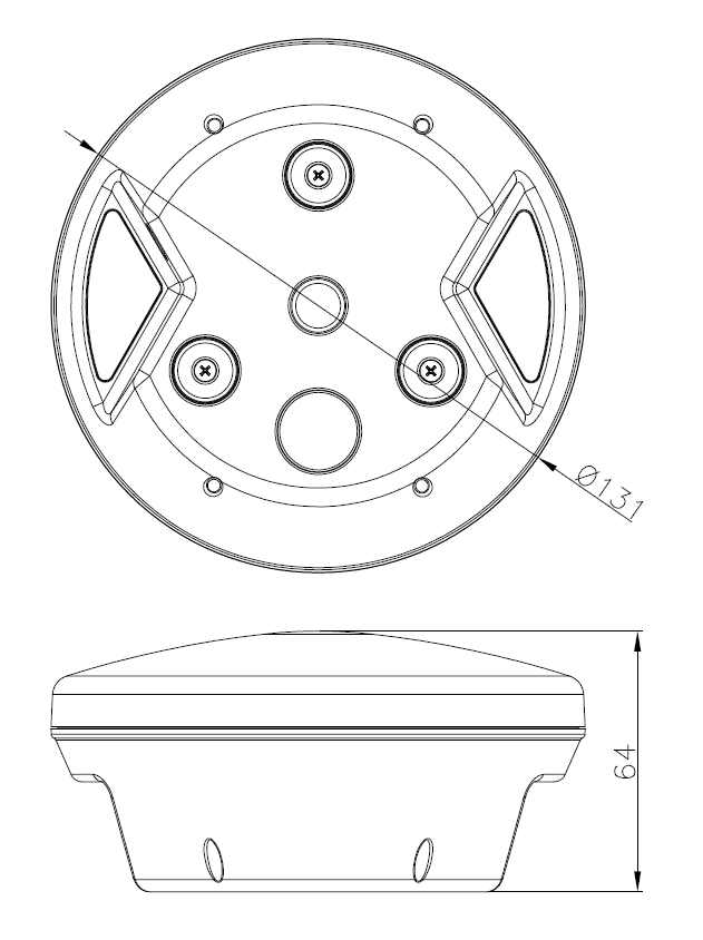
The GNSS satellite receiver and antenna are placed in a rugged weather-resistant plastic housing manufactured using automotive grade plastic. The device is equipped with connectors with IP68 grade and has a valve which prevents the accumulation of moisture inside the case when operating over a wide temperature range. The upper part of the unit is made of white plastic to prevent the device from overheating by direct sunlight. Three powerful Ø16mm magnets lie on the lower part of the casing, securely fixing the receiver on any metal surface. The bright multicolor LED Indicator displays all device operation status, navigation mode, radio status.
DESIGNED TO WORK IN THE FIELD
Our internal software not only provides tools for daily use of the receiver but opens up new opportunities for better performance:
- AutoBASE makes an easiest way to repeat the setup of RTK base station on a daily basis. It automatically sets the coordinates of the base station for reuse at a fixed point. It is possible to save up to 32 installation points in the memory unit. When point is activated, the software helps to simultaneously adjust the corresponding frequency of the radio module.
- CoWORK – supports grouping vehicles (up to 8 units) at one field with real-time monitoring of every unit’s position (requires RTK receiver, radio module and display software support).
- ACURATE — proprietary technology provides path to path navigation accuracy lower to 20 cm @ 40 minutes w/o external corrections, it based on advanced GNSS receiver with true raw measurements output. This technology has many years field proven accuracy.
CUSTOMIZATION — OEM
Appearance of the device, its accessories and cables — it all can be customized. The color of the lower part of the case can be made in accordance with the preferences of the customer (the RAL is required, the MOQ is 500 pcs). The inner PCB has no manufacturer ID, so all labels can be designed by the customer. The smart-antenna design allows manufacturer to build a combination of navigation modules, antennas and radio modules required in the customer’s project to achieve the required cost/accuracy/flexibility. The ability to use key components from different manufacturers makes it easier to manage the product lifecycle. The cables will customized on customers’s request, cable type, connector and pin-out.
GNSS NAVIGATION MODULE
- ACURATE L1 – proprietary firmware based on GNSS-receiver with RAW measurements output
- RTK L1/L2/B2/E5 – ZED-F9P (base/rover)
- RTK L1/L2/B2/E5/L-BAND – ZED-F9P + SSR companion receiver module) (rover)
Other modules at the same form factor is compatible with our platform, firmware support are required.
GNSS ANTENNA
- L1 GNSS – TW2406 or similar
- L2/L2 GNSS – TW3887 or similar
- L1/L2/L-band – TW3967 or similar
RADIO INTERFACE
- 433/868/915MHz ISM-Band radio module with up to 10 km radio-link for RTK corrections or CoWORK mode, external antenna required, TNC IP68 connector.
- Bluetooth 3.0 module for settings or communication with terminal equipment, internal antenna
- WiFi b/g/n module for receiving or streaming the RTCM using NTRIP, requires external caster, Internet connection, internal antenna.
CABLE
- LTW-AMPHENOL 6pin to DSUB-9F, 5m
- LTW-AMPHENOL 6pin to open wire, up to 15m
- LTW-AMPHENOL 6pin to any connector and cable length up to 15m
GNSS RECEIVER SPECIFICATION
- Receiver Type: ACURATE L1 / RTK L1/L2/B2/E5
- Signals Received: GALLILEO / BeiDou / GPS and GLONASS
- Channels: 72 / 184 (depend on used GNSS module)
- GNSS Sensitivity: tracking & nav. -167 dBm, cold starts -148 dBm, hot starts -157 dBm, Reacquisition -160 dBm
- Update Rate: ACURATE up to 5 Hz, RTK up to 20 Hz
- Cold Start: < 24 s typical (no almanac, ephemeris, position, or RTC)
- Warm Start: < 2 s typical (current almanac and RTC)
- Hot Start: < 2 s typical (current almanac, ephemeris, position, and RTC)
- Maximum Speed: 1,800 km/h (500 m/s)
- Maximum Altitude: up to 50.000m
SATELLITE TRACKING (FREQUENCY BAND)
- GPS: L1C/A (1575.42 MHz), L2C (1227.6 MHz)
- GLONASS: L1OF (1598.0625 MHz…1609.3125 MHz), L2OF (1242.9375 MHz…1251.6875 MHz)
- BeiDou: B1I (1561.098 MHz), B2I (1207.14 MHz)
- Galileo: E1B/C (1575.42 MHz), E5B (1207.14 MHz)
- QZSS: L1C/A (1575.42 MHz), L2C (1227.6 MHz)
POSITIONING ACCURACY
| Horizontal Accuracy: | RMS (67%) | 2DRMS (95%) |
| RTK: 1,2 | 10 mm + 1 ppm | 20 mm + 1 ppm |
| SSR — assisted: 1,3 | TBD | TBD |
| SBAS (WAAS): 1 | 0.3 m | 0.6 m |
| Autonomous, no SA: 1 | 1.5 m | 2.5 m |
| ACURATE: | 0.2 m path to path @ 40 minutes interval |
COMMUNICATIONS
- Serial Ports: 2 full-duplex RS-232, Baud Rates: 9600-460800
- Correction I/O Protocol: RTCM v3.1, RTCM v3.2 (RTK)
- Data I/O Protocol: NMEA 0183 v4.0 + proprietary NMEA messages
POWER
- Input Voltage: 8-60 VDC, overvoltage protection
- Power Consumption: TBD4 nominal (L1/L2 GPS/GLONASS; L-band)
- Current Consumption: TBD4 nominal (L1/L2 GPS/GLONASS; L-band)
- Power Isolation: No
- Reverse Polarity Protection: Yes
- Antenna Voltage: Internal GNSS Antenna
ENVIRONMENTAL
- Operating Temperature: -40°C to +70°C (-40°F to +158°F)
- Storage Temperature: -40°C to +85°C (-40°F to +185°F)
- Humidity: 95% non-condensing
- Enclosure: UV resistant plastic, IP67 grade
MECHANICAL
- Dimensions: Ø 131 mm x H 64 mm
- Weight: < 0.6 kg
- Status Indications (LED): Power, GNSS Lock, RADIO Status
- Power/Data Connector: 6-pin male plastic LTW-AMPHENOL, IP68 grade
- Antenna Mounting: 5/8-11 UNC thread, lower surface has 3 optional magnetics
DOWNLOADS
- Datasheet of SmartGNSS antenna
- Drawings or SmartGNSS antenna
- Datasheet for watetproof cable
CONTACTS
SmartGNSS Project, sales@smartgnss.net
NOTES
1 It depends on multipath environment, number of satellites in view, satellite geometry, and ionosphere activity
2 It depends on baseline length
3 It depend on characteristics of future SSR companion module
4 Based on current consumption of used GNSS-module
COPYRIGHT SMARTGNSS PROJECT — ©2022